SJ Initiative shifts its focus to the ‘uplands’
Published 11:08 am Thursday, July 16, 2009
The San Juan Initiative has a new task at hand. Members of the Initiative, after receiving an enthusiastic endorsement from the County Council late last year for devising a “tailored” approach in crafting future shoreline regulations, are in the process of replicating for the uplands what they did for the waterfront.
In a unanimous decision, the council on June 23 gave the Initiative a green light to embark on developing similar recommendations for regulating the so-called “terrestrial” areas of the islands.
Initiative Coordinator Amy Windrope said the effort on behalf of the uplands, those areas beyond the 200 feet shoreline zone, is being funded by a $50,000 grant from the U.S. Fish and Wildlife Service, which also help to bankroll its two-year evaluation of local shorelines. The initiative, she said, has hosted nearly a half-dozen public workshops over the past two months should be solvent at least through October thanks to the federal grant.
Launched nearly three years ago, the San Juan Initiative is a component of the larger Puget Sound Initiative, a commitment by the state to restoring the health of its inland marine waters by 2020. The Puget Sound Initiative is chaired by Bill Ruckelhaus, a part-time resident of San Juan Island who twice served as director of the U.S. Environmental Protection Agency, as well as assistant U.S. attorney general and FBI director.
The San Juan Initiative, driven by the goal of striking a regulatory balance through a collaborative process, and tasked with developing recommendations that improve the protection of natural resources and wildlife habitat without stripping local residents and the community of the ability to prosper, has been touted as a model which other cities, counties and communities can follow.
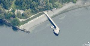
The initiative’s list of shoreline recommendations feature a tailored approach to regulating development, wherein the natural features of a particular stretch of waterfront, such as protruding rocky bluffs versus low-lying sandy beaches, rather than a “one size fits all” type of approach, would prevail. In crafting its recommendations, the initiative relied on the expertise of a policy group consisting of 13 islanders working in collaboration with high-ranking officials of 10 separate agencies — federal, state, tribal and local — and with the input from a team of six scientists and eight local policy experts, and ultimately, the public.
According to Windrope, the initiative supports including incentives in local rules in which development that protects or benefits the environment is rewarded and non-compliance is discouraged. Furthermore, she noted, members of the initiative believe that management of vegetation within buffer zones may prove as important, or more, in protecting habitat than is the size or the distance of those buffer zones or setbacks.
To what extent the initiative’s shoreline recommendations are woven into the fabric of local development rules, namely the update of the county’s critical areas ordinance and the pending revision of its shoreline master program, remains to be seen. Lines have already been drawn, over the CAO update in particular, between supporters of greater setbacks and those that oppose any change. Flexibility, Windrope said, could be the key in producing something both factions can support.
“A tailored approach gets a very strong backing from the public in its ability to bring us together, where a blanket approach does not,” she said.